Imagine you're planning a road trip using a traditional paper map. You trace your finger between two points, excited about your adventure. But how do you determine the actual distance you'll be traveling? This is where the concept of map scale comes into play. A map scale is a crucial element that acts as a bridge between the representation of the world on a map and the actual distances on the Earth's surface.
In essence, map scale tells you the ratio or relationship between a distance measured on a map and the corresponding distance on the ground. It allows you to translate the miniaturized world depicted on your map into real-world measurements, making your planning more accurate and efficient. Without a map scale, a map would just be a pretty picture, lacking the essential information needed for navigation and understanding spatial relationships.
Map scales have been a fundamental part of cartography, the science of mapmaking, for centuries. Their origins can be traced back to ancient civilizations that created maps for navigation, land management, and military strategies. As maps evolved, so did the methods of representing scale. Today, we encounter map scales in various forms, each with its own advantages.
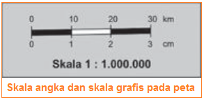
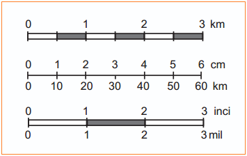
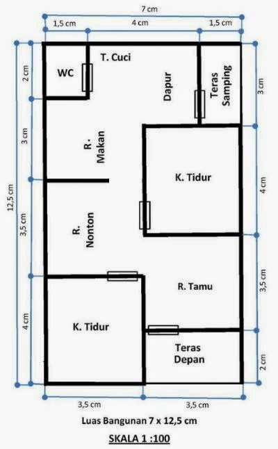
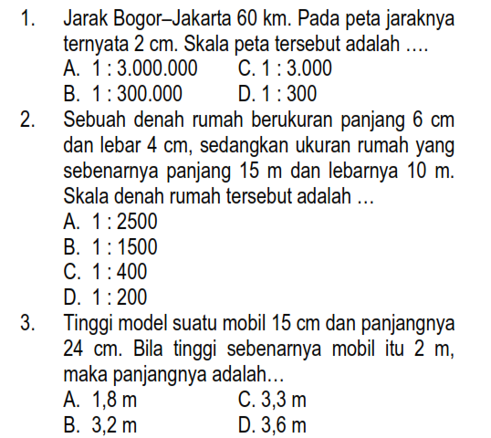
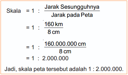
One common type is the "ratio scale," often represented as a ratio like 1:50,000. This means that one unit of measurement on the map corresponds to 50,000 units on the ground. So, if you measure 1 centimeter on the map, it represents 50,000 centimeters (or 500 meters) in reality. Another type is the "verbal scale," which expresses the scale relationship in words, such as "One inch equals one mile." This straightforward approach is easier to understand for many users.
The importance of understanding map scales cannot be overstated. Whether you're a seasoned explorer, a city planner, or simply someone who enjoys using maps, a firm grasp of scale allows you to:
- Accurately calculate distances: By using the map scale, you can convert distances measured on the map to actual distances, enabling you to plan routes, estimate travel times, and understand the spatial relationships between different locations.
- Compare sizes and areas: Map scales help you visualize and compare the relative sizes of different features on a map, providing insights into the scale and magnitude of geographical phenomena.
- Interpret spatial patterns: By understanding the relationship between map distance and real distance, you can analyze spatial patterns, distributions, and relationships between different elements on a map, leading to a deeper understanding of geographical concepts.
Advantages and Disadvantages of Different Map Scale Representations
While all map scales serve the same fundamental purpose, different representation methods come with their own sets of advantages and disadvantages:
| Map Scale Type | Advantages | Disadvantages |
|---|---|---|
| Ratio Scale (e.g., 1:50,000) |
|
|
| Verbal Scale (e.g., "One inch equals one mile") |
|
|
Best Practices for Working with Map Scales
Here are some practical tips for effectively using and interpreting map scales:
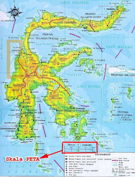
- Identify the Scale: Always check the map legend to find the map scale before making any distance calculations or interpretations.
- Choose the Right Units: Pay attention to the units used in the scale (e.g., centimeters, inches, kilometers, miles) and ensure consistency when measuring distances on the map and converting them to real-world values.
- Use a Ruler or Measuring Tool: For accurate measurements, use a ruler, divider, or a dedicated map measuring tool instead of estimating distances by eye.
- Consider Terrain: Keep in mind that map scales represent horizontal distances. If you're dealing with hilly or mountainous areas, the actual distance traveled on the ground will be longer than the straight-line distance measured on the map.
- Be Aware of Scale Variations: Some maps may have varying scales within different sections, especially for large areas. Always double-check the scale if you're working with maps covering extensive regions.
Challenges and Solutions in Using Map Scales
While map scales are essential tools, their use can present certain challenges:
- Challenge: Dealing with map distortions. Solution: Be aware that all map projections introduce some level of distortion, especially at larger scales. Consider the type of projection used and its potential impact on distance accuracy.
- Challenge: Interpreting scales on digital maps. Solution: Digital maps often adjust the displayed scale dynamically as you zoom in or out. Pay attention to the scale indicator, which may be displayed as a ratio, a bar scale, or a combination of both.
- Challenge: Estimating distances on maps without scales. Solution: While not ideal, you can sometimes estimate distances by using known landmarks or features as reference points. However, this method is less accurate and should only be used as a last resort.
Frequently Asked Questions about Map Scales
Here are answers to some common queries about map scales:
- Q: What is a large-scale map? A: A large-scale map shows a smaller area with more detail, often used for city plans or local maps. Examples include maps with scales of 1:25,000 or 1:10,000.
- Q: What is a small-scale map? A: A small-scale map depicts a larger area with less detail, typically used for world maps or regional maps. Examples include scales like 1:1,000,000 or 1:5,000,000.
- Q: Can I create my own map scale? A: Yes, you can create a custom map scale if you know the desired ratio or relationship between map distance and real-world distance.
Conclusion
Map scales are fundamental elements of cartography that bridge the gap between the representation of the world on a map and the actual distances on the Earth. They empower us to navigate, plan, and understand spatial relationships with accuracy and confidence. Whether you encounter ratio scales, verbal scales, or other forms of scale representation, the ability to interpret and utilize this information is crucial for anyone who interacts with maps. By grasping the significance of map scales, we gain a deeper appreciation for the power of maps as tools for exploration, analysis, and communication.
contoh skala pada peta - Trees By Bike
contoh skala pada peta - Trees By Bike
contoh skala pada peta - Trees By Bike
contoh skala pada peta - Trees By Bike
contoh skala pada peta - Trees By Bike
contoh skala pada peta - Trees By Bike
contoh skala pada peta - Trees By Bike
contoh skala pada peta - Trees By Bike
contoh skala pada peta - Trees By Bike
contoh skala pada peta - Trees By Bike
contoh skala pada peta - Trees By Bike
contoh skala pada peta - Trees By Bike
contoh skala pada peta - Trees By Bike
contoh skala pada peta - Trees By Bike
contoh skala pada peta - Trees By Bike
