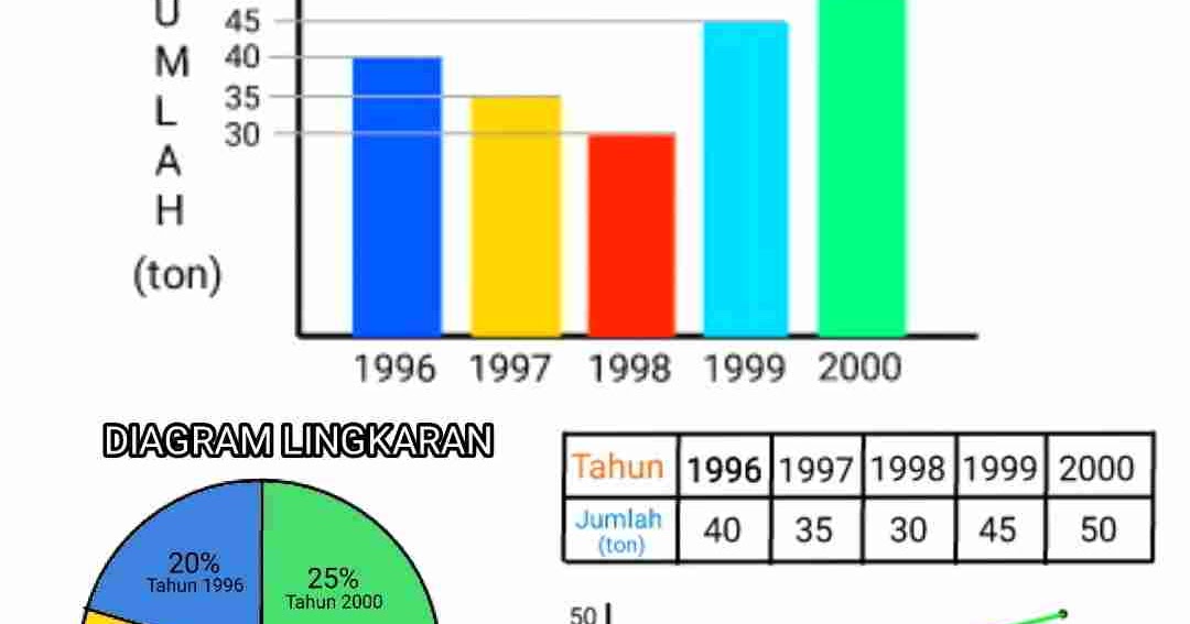
Imagine unfolding a map, your finger tracing the lines of a distant country, a mountain range you long to explore. You envision vast landscapes, but how do you translate the miniature world on paper to the immensity of reality? The answer lies in a seemingly simple, yet powerful tool: the scale bar.
A scale bar, often tucked away in the corner of your map, is more than just a line with numbers. It's the key to understanding the true proportions of the area represented, the silent language that bridges the gap between cartographic representation and the physical world.
Whether you're a seasoned hiker navigating through dense forests or an armchair traveler dreaming of far-off places, grasping the concept of scale bars is essential. It's about more than just knowing how far one point is from another; it's about comprehending the magnitude of our planet and the intricacies of geographical features.
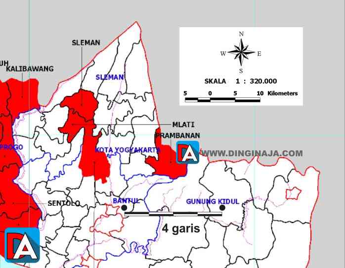
In essence, a scale bar provides a visual representation of the relationship between distances on a map and their corresponding distances in the real world. This seemingly simple tool unlocks a deeper level of understanding about the area depicted, allowing you to accurately gauge distances, compare the sizes of different features, and plan your explorations effectively.
While its appearance might seem straightforward, the ability to interpret a scale bar is crucial for anyone who interacts with maps, from students in geography class to urban planners designing cities. It's a fundamental skill that empowers us to navigate, understand, and appreciate the world around us.
Throughout history, maps have evolved from rudimentary sketches on cave walls to intricate digital renderings. The concept of scale, however, has remained a constant. From the earliest known world maps created by the ancient Greeks to the sophisticated GPS systems we use today, accurately representing distance has always been a cornerstone of cartography.
The methods for depicting scale have also transformed over time. Early maps often relied on verbal scales, expressing the relationship between map distance and real-world distance through written statements. As cartography advanced, graphic scales, represented by lines marked with corresponding distances, gained popularity for their visual clarity and ease of use. Today, while digital maps often provide automatic distance calculations, the fundamental principle of the scale bar remains as relevant as ever.
Advantages and Disadvantages of Using Scale Bars
| Advantages | Disadvantages |
|---|---|
| Easy to understand and use. | Can be inaccurate if the map is enlarged or reduced without adjusting the scale bar. |
| Provides a quick visual representation of distance. | May not be suitable for all types of maps or for representing very large or small areas. |
| Universally recognized and used on most maps. |
Best Practices for Utilizing Scale Bars
1. Identify the Scale: Always locate and examine the scale bar before interpreting any distances on a map. Different maps may utilize different scales depending on their purpose and the area covered.
2. Measure Carefully: Use a ruler or a similar tool to accurately measure the distance on the map you wish to convert to real-world distance. Even slight inaccuracies in measurement can lead to significant discrepancies in your calculations.
3. Convert Units: Pay close attention to the units used on the scale bar (e.g., miles, kilometers). If necessary, convert the units to match your preferred measurement system.
4. Account for Map Projections: Remember that maps are representations of a three-dimensional sphere (the Earth) on a two-dimensional surface. This can lead to distortions in distance, especially over large areas.
5. Verify with Other Sources: Whenever possible, verify your distance calculations using additional resources, such as online mapping tools or GPS devices, to ensure accuracy.
Challenges and Solutions in Using Scale Bars
Challenge 1: Distortion due to map projections.
Solution: Use maps with projections suitable for the area of interest. For instance, conformal projections preserve angles and shapes, making them suitable for navigation, while equal-area projections maintain accurate area ratios, which is beneficial for thematic maps.
Challenge 2: Difficulty in estimating distances for curved or irregular lines on a map.
Solution: Use a piece of string to trace the curved line on the map, then straighten out the string and measure its length against the scale bar. This method provides a more accurate estimation for non-linear paths.
Challenge 3: Lack of a scale bar on older or hand-drawn maps.
Solution: Look for other clues on the map, such as known landmarks or distances between major cities, to estimate the scale. If available, compare the map to a modern map with a known scale to deduce an approximate scale.
Frequently Asked Questions about Scale Bars
1. What is the primary purpose of a scale bar on a map? A: A scale bar provides a visual representation of the relationship between distances measured on the map and their corresponding distances in the real world.
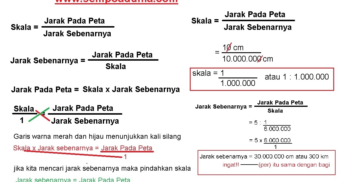
2. Why are there different types of scale bars? A: Different types of scale bars, such as linear or ratio scales, are used to cater to specific map purposes or scales. Linear scales are visually intuitive for measuring distances directly, while ratio scales, often expressed as fractions, are suitable for maps intended to be enlarged or reduced.
3. How do I choose the appropriate scale for a map? A: The appropriate scale depends on the purpose of the map and the area being represented. Larger scales are suitable for detailed maps of small areas, while smaller scales are necessary for maps depicting larger regions or the entire world.
Tips for Mastering Scale Bar Interpretation
- Always double-check your measurements and calculations to ensure accuracy. Small errors can lead to significant discrepancies in distance estimations.
- Be mindful of the units used on the scale bar and convert them if necessary to align with your preferred measurement system.
- When using online maps or GPS devices, pay attention to the scale indicator, which often adjusts dynamically as you zoom in or out.
In conclusion, understanding how to interpret scale bars is an indispensable skill for anyone who interacts with maps. It's about more than just knowing how far one point is from another; it's about comprehending the vastness of our world, appreciating the intricacies of geographical features, and navigating our physical space with confidence. By mastering this fundamental skill, we unlock a deeper level of understanding and appreciation for the maps that guide our explorations and shape our understanding of the world around us. So, the next time you unfold a map, take a moment to appreciate the power of the scale bar – the unsung hero of cartography that allows us to bridge the gap between representation and reality.
cara membaca skala batang - Trees By Bike
cara membaca skala batang - Trees By Bike
cara membaca skala batang - Trees By Bike
cara membaca skala batang - Trees By Bike
cara membaca skala batang - Trees By Bike
cara membaca skala batang - Trees By Bike
cara membaca skala batang - Trees By Bike
cara membaca skala batang - Trees By Bike
cara membaca skala batang - Trees By Bike
cara membaca skala batang - Trees By Bike
cara membaca skala batang - Trees By Bike
cara membaca skala batang - Trees By Bike
cara membaca skala batang - Trees By Bike
cara membaca skala batang - Trees By Bike
cara membaca skala batang - Trees By Bike


